 TemperateReefBase Geonetwork Catalogue
Abundance of biota
Type of resources
Topics
Keywords
Contact for the resource
Provided by
Years
-
Mesozooplankton community composition and structure were examined throughout the D’Entrecasteaux Channel, Huon Estuary and North West Bay, Tasmania, from November 2004 to October 2005. The composition of the mesozooplankton community was typical of inshore, temperate marine habitats, with seasonally higher abundance in summer and autumn and lower numbers in winter and spring. Copepods were the largest contributors to total abundance across all seasons and stations, while cladocerans and appendicularians were proportionally abundant in spring and summer. The faecal pellets of these three main groups, along with those of krill and amphipods, also contributed significantly to material recovered from sediment traps. Meroplanktonic larvae of benthic animals showed short-term peaks in abundance and were often absent from the water column for long periods. Spatially, North West Bay and the Channel had a higher representation of typically marine species, including Calanus australis and Labidocera cervi, while truly estuarine species, such as the copepod Gladioferens pectinatus, were more important in the Huon Estuary.
-

[This data has been superseded by a synthesised global dataset which includes additional ecological data contributed by non-RLS entities (National Reef Monitoring Network). Please visit the corresponding NRMN Collection (IMOS - National Reef Monitoring Network Sub-Facility - Global off-transect species observations || Global reef fish abundance and biomass) for the most current version of this data. See "Downloads and Links" section below.] This dataset contains records of bony fishes and elasmobranchs collected by Reef Life Survey (RLS) divers along 50m transects on shallow rocky and coral reefs, worldwide. Abundance information is available for all records found within quantitative survey limits (50 x 5 m swathes during a single swim either side of the transect line, each distinguished as a Block), and out-of-survey records are identified as presence-only (Method 0). Although surveys are undertaken as part of monitoring programs at particular locations (mostly in Australia), this dataset contains does not include repeat surveys of sites. This data has been superseded by the NRMN collections "IMOS - National Reef Monitoring Network - Global reef fish abundance and biomass" (http://catalogue-imos.aodn.org.au/geonetwork/srv/eng/catalog.search#/metadata/b273fafa-03d6-4fc2-9acf-39d8c06581e5) and "IMOS - National Reef Monitoring Network - Global off-transect species observations" (http://catalogue-imos.aodn.org.au/geonetwork/srv/eng/catalog.search#/metadata/a73907b7-3686-4dcf-8a1d-7efc4e5ffc05).
-

Observational data for the Kelp Ecosystem Ecology Network. These data come from transects of rocky reefs taken around the world using the KEEN observational data protocol (see http://kelpecosystems.org for full description of methods and handbook). See “How” for methods. Briefly, the observational data consists of the following components, all included here: site information, fish observations, quadrat sampling, band transect sampling, percent cover from uniform point counts, and kelp morphometrics. Data Files Data files included and what they contain are as follows: keen_sites.csv - Physical and locational data for all KEEN sites and transect. keen_cover.csv - Percent cover of sessile algae and invertebrates. keen_fish.csv - Counts of fish by size class along a transect. keen_quads.csv - Counts of common algae, sessile invertebrates, and demersal fish that can be individuated. keen_swath.csv - Counts of rarer algae, sessile invertebrates, and demersal fish that can be individuated. Data Use To use the observational data here for published work we ask that 1) You contact the network coordinator, jarrett.byrnes@umb.edu, and notify them of your intention so that we can coordinate among any ongoing projects using the same data, 2) if the data has not been used in a publication in the literature before, we request that you reach out to the PIs responsible for the data you will be using and engage in a conversation about co-authorship, 3) if it has been used previously, merely cite the datasets associated with each PI that you use. The references are listed below. For access to the entire data cleaning and processing pipeline, see https://github.com/kelpecosystems/observational_data. For access to scans of the original data sheets, contact jarrett.byrnes@umb.edu. ------------------------------------------------------ For general methods: Byrnes, Jarrett E.K., Haupt, Alison J., Reed, Daniel C., Wernberg, Thomas., Pérez-Matus, Alejandro., Shears, Nick T., Konar, Brenda, Gagnon, Pat, and Vergés, Adriana. 2014. Kelp Ecosystem Ecology Network Monitoring Handbook. Kelp Ecosystem Ecology Network. For specific data sets, use the following, but also include date accessed from TemperateReefBase in order to track which version of the data you are using. Byrnes, Jarrett E.K., Haupt, Alison J., Lyman, Ted. 2014. Kelp forest communities at Appledore Island, the Boston Harbor Islands, and Salem Sound. Kelp Ecosystem Ecology Network. Dijkstra, Jennifer A., Mello, Kristen. 2015. Kelp forest communities at York, Maine. Kelp Ecosystem Ecology Network. Grabwoski, Jonathan and MacMahan, Marissa. 2015. Kelp forest communities in Nahant, Massachusetts, and Pemaquid, Maine. Kelp Ecosystem Ecology Network. Humphries Austin T., Paight C, Ben-Horin Tal, Green Lindsay, Thornber, Carol. 2016. Kelp forest communities in Narragansett Bay, Rhode Island. Kelp Ecosystem Ecology Network. Rasher, Douglass and Price, Nicole. 2017. Kelp forest communities of central and downeast Maine. Kelp Ecosystem Ecology Network. Peréz-Matus, Alejandro and Shaughnessy, Brianna. 2017. Kelp forest communities of central and northern Chile. Kelp Ecosystem Ecology Network.
-
Diel partitioning of animals within ecological communities is widely acknowledged, yet rarely quantified. Investigation of most ecological patterns and processes involves convenient daylight sampling, with little consideration of the contributions of nocturnal taxa, particularly in marine environments. Here we assess diel partitioning of reef faunal assemblages at a continental scale utilizing paired day and night visual census across 54 shallow tropical and temperate reefs around Australia. Day/night differences were most pronounced in the tropics, with fishes and invertebrates displaying distinct and opposing diel occupancy on coral reefs. Tropical reefs in daytime were occupied primarily by fishes not observed at night (64% of all species sighted across day and night, and 71% of all individuals). By night, substantial emergence of invertebrates not otherwise detected during sunlit hours occurred (56% of all species, and 45% of individuals). Nocturnal emergence of tropical invertebrates corresponded with significant declines in the richness and biomass of predatory and herbivorous diurnal fishes. In contrast, relatively small diel changes in fishes active on temperate reefs corresponded to limited nocturnal emergence of temperate invertebrates. This reduced partitioning may, at least in part, be a result of strong top-down pressures from fishes on invertebrate communities, either by predation or competitive interference. For shallow reefs, the diel cycle triggers distinct emergence and retreat of faunal assemblages and associated trophic patterns and processes, which otherwise go unnoticed during hours of regular scientific monitoring. Improved understanding of reef ecology, and management of reef ecosystems, requires greater consideration of nocturnal interactions. Without explicit sampling of nocturnal patterns and processes, we may be missing up to half of the story when assessing ecological interactions.
-
Zooplankton samples were collected at two sites in south eastern Tasmania, between the years 2000 and 2001 using two types of plankton net. Samples were collected using horizontal hauls during the daytime only. All copepods, salps and chaetognaths were identified and enumerated.
-
Zooplankton was counted and identified from three sites over the 5-year period. The net used (200 m Bongo net) was designed to catch meso-zooplankton with an integrated vertical tow through the water column. One net from each of the paired Bongo samples was analysed and the data expressed as numbers per m3. Copepods dominated the zooplankton, with other groups such as salps, krill, appendicularians, cladocerans, chaetognaths and meroplanktonic larvae being seasonally dominant.
-
Phytoplankton was counted and identified from five sites over the 5-year period. Annual cycles in abundance are available (as cells mL-1), along with detailed species identification. Cell measurements and approximate geometric shape were also recorded for the calculation of biovolume (μL cell-1). Diatoms and dinoflagellates dominated the samples in terms of biomass, however, small cells were also very abundant throughout each year. The data are restricted to an integrated sample from the top 12 m of the water column. Fluorescence profiles elsewhere in this dataset can provide an indication of phytoplankton presence lower in the water column.
-
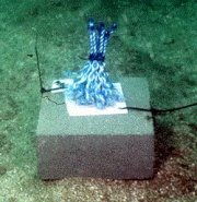
The Tasman Fracture CMR AUV survey was a pilot study undertaken in 2014/15 as part of the National Marine Biodiversity Hub's National monitoring, evaluation and reporting theme. The aim of this theme is to develop a bluepint for the sustained monitoring of the South-east Commonwealth Marine Reserve Network. The particular aim of the survey was to contribute to an inventory of the distribution and abundance of demersal fishes in the reserve and adjacent reference sites using BRUVs. Data contained here represents footage collected using these drops and the associated scored data (abundance and lengths).
-
Community assembly in macrofauna communities developed in artificial kelp holdfasts was monitored at 1-month intervals over a 13 month period using a sampling design that used systematic patterns of temporal overlap and changes in start and collection dates. The hierarchical nature of the experimental design allowed several different approaches to analysis; by date of deployment and by date of collection of the artificial habitats, which enabled comparison of community assembly with and without the seasonal effects of the date of collection, and by community age to test whether there were alternative end-states to assembly depending on season or recruitment history.
-
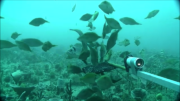
The Flinders CMR survey was a pilot study undertaken in August 2012 as part of the National Marine Biodiversity Hub's National monitoring, evaluation and reporting theme. The aim of this theme is to develop a bluepint for the sustained monitoring of the South-east Commonwealth Marine Reserve Network. The particular aims of the survey were twofold; 1) to contribute to an inventory of demersal and epibenthic conservation values in the reserve and 2) to test methodologies and deployment strategies in order to inform future survey design efforts. Several gear types were deployed; including multibeam sonar, shallow-water (less than 150m) Baited Remote Underwater Video (BRUVs), deep- water BRUVs, towed video and digital stereo stills. This resource contains the shallow-water BRUV footage captured on the FLinders CMR shelf (less than 150 m). Stereo BRUV's were deployed using a probabalistic and spatially-balanced survey design called Generalized Random Tessellation Stratified (GRTS). Habitats were identified in a previous multibeam survey and consisted of 'mixed reef' (containing patchy reef) and sand. Mixed reef habitat was targeted in this survey (9 GRTS mixed reef sites versus 3 sand sites). A total of 60 stereo BRUVs were deployed. Data contained here represents footage collected using these drops and the associated scored data (abundance (MaxN) and lengths).