 TemperateReefBase Geonetwork Catalogue
EARTH SCIENCE | BIOSPHERE | AQUATIC ECOSYSTEMS | MARINE HABITAT
Type of resources
Topics
Keywords
Contact for the resource
Provided by
Years
-

An aerial survey was conducted for giant kelp (Macrocystis pyrifera) on the east coast of Tasmania from Eddystone Point to Southeast Cape. This survey represents part of a series of similar surveys, with historic aerial surveys having been conducted in 1986 and 1999. The survey was conducted via light aircraft. Areas of visable Macrocystis pyrifera beds were marked on topographical land tenure maps using landmarks as references, and complimentary photo footage was collected.
-

An aerial survey of giant kelp (Macrocystis pyrifera), was carried out on the east coast of Tasmania from Musselroe Bay to Southeast Cape. This survey represents part of a series of similar surveys, with historic aerial surveys having been conducted in 1986, 1999 and 2009. This survey was conducted via light aircraft in Nov-Dec 2019, and recorded areas of visible surface canopy cover of giant kelp. Canopy areas were scribed in-flight onto 1:50,000 topographic maps (TASMAP 2017), and complimentary photo and video footage was collected. Canopy areas were digitised with reference to photo, video and map data within QGIS 3.4, and boundaries were checked against Seamap Australia seafloor habitats (Lucieer et al. 2017) and bathymetric data (Smith 2016). Each bed was attributed a broad and fine scale location, density and reliability estimate (see attached report for details). This survey was completed with funding from Pennicott Wilderness Journeys, Tassal and IMAS, and equal in-kind support by Marine Solutions and Seacare Inc.
-

This record describes an aggregated data product compiled from a number of different surveys of Macrocystis surface cover in Tasmanian waters, spanning 1950 to 2019. Some surveys represent a statewide census of Macrocystis cover, while others are targeted surveys of smaller regions. Methodology and data quality may also vary between surveys. Please see linked metadata records for specific methodologies and quality statements applying to individual surveys.
-
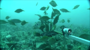
The Flinders CMR survey was a pilot study undertaken in August 2012 as part of the National Marine Biodiversity Hub's National monitoring, evaluation and reporting theme. The aim of this theme is to develop a bluepint for the sustained monitoring of the South-east Commonwealth Marine Reserve Network. The particular aims of the survey were twofold; 1) to contribute to an inventory of demersal and epibenthic conservation values in the reserve and 2) to test methodologies and deployment strategies in order to inform future survey design efforts. Several gear types were deployed; including multibeam sonar, shallow-water (less than 150m) Baited Remote Underwater Video (BRUVs), deep- water BRUVs, towed video and digital stereo stills. This resource contains the shallow-water BRUV footage captured on the FLinders CMR shelf (less than 150 m). Stereo BRUV's were deployed using a probabalistic and spatially-balanced survey design called Generalized Random Tessellation Stratified (GRTS). Habitats were identified in a previous multibeam survey and consisted of 'mixed reef' (containing patchy reef) and sand. Mixed reef habitat was targeted in this survey (9 GRTS mixed reef sites versus 3 sand sites). A total of 60 stereo BRUVs were deployed. Data contained here represents footage collected using these drops and the associated scored data (abundance (MaxN) and lengths).
-
The Tasman Fracture CMR AUV survey was a pilot study undertaken in 2014/15 as part of the National Marine Biodiversity Hub's National monitoring, evaluation and reporting theme. The aim of this theme is to develop a blueprint for the sustained monitoring of the South-east Commonwealth Marine Reserve Network. The particular aim of the survey was to contribute to an inventory of the distribution and abundance of southern rock lobster (Jasus edwardsi). Data contained here represents the data collected from lobster potting component of the study. This includes lobster abundance, gender and length. Bycatch is also recorded.
-

A research program jointly conducted by Alginates (Australia) P/L and C.S.I.R.O. Division of Fisheries and Oceanography was set up to investigate the relationship between kelp: Macrocystis pyrifera (Linnaeus) C. Agardh 1820 and crayfish larvae. Alginates (Australia) P/L, based at Louisville in the Mercury Passage, were harvesting kelp at this time. This study was initiated to address concerns regarding the effect of harvesting on crayfish stocks. The survey results are taken from an unpublished interim report presenting the results of the work at that stage (1965). Apparently an aerial survey was used to determine stock distributions although this is not specified in the report.
-

As a condition of licence for harvesting Macrocystis pyrifera (Linnaeus) C. Agardh 1820, Alginates (Australia) P/L lodged harvest returns to the Tasmanian Lands Department. The harvest returns consisted of what tonnage was harvested from where, when and the length of trip. While Alginates (Australia) P/L harvested from 1964-1973, harvest data for individual sites is only available for the years 1970-71. Here the data is summed for individual sites for the two years 1970-71.
-

Surveys were conducted as part of an assessment of the Macrocystis pyrifera (Linnaeus) C. Agardh 1820 beds on the east coast of Tasmania by the Commonwealth Scientific and Industry Research Organization (CSIRO) Division of Fisheries seaweed program in the early 1950's. Surveys were conducted because of interest in the Macrocystis beds as a source of alginates. Surveys were done between 1950 and mid 1953. The paper was published in 1954.
-

A survey was conducted for Macrocystis pyrifera (Linnaeus) C. Agardh 1820 from Eddystone Point to South East Cape The survey was conducted from light aeroplane. Areas of Macrocystis pyrifera beds were marked on 1:100,000 topographical land tenure maps using landmarks as references. A Trimble GPS unit was used to track position in the aeroplane. As boundaries of the beds were flown over, these were marked on the GPS. When plotted up, these information assisted in determining Macrocystis bed boundaries where these were not close to the coast.
-

The results of this survey are based primarily on the first hand experience of Craig Sanderson who was doing his masters thesis at the time on aspects of the biology of Macrocystis pyrifera (Linnaeus) C. Agardh 1820. In need of significant beds of M. pyrifera for research much of the east coast was searched by boat. Significant stands (>1/2 acre) were found at Darlington, Southerly Bottom (East North Bay), Fortesque Bay and George III Rock, (near Actaeon Island). The status of the few areas not visited was determined from anecdotal reports.