Keyword

SPONGES

3 record(s)
 
Type of resources
Topics
Keywords
Contact for the resource
Provided by
Years
From 1 - 3 / 3
  • Categories  

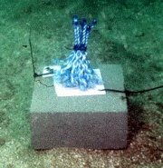
    Community assembly in macrofauna communities developed in artificial kelp holdfasts was monitored at 1-month intervals over a 13 month period using a sampling design that used systematic patterns of temporal overlap and changes in start and collection dates. The hierarchical nature of the experimental design allowed several different approaches to analysis; by date of deployment and by date of collection of the artificial habitats, which enabled comparison of community assembly with and without the seasonal effects of the date of collection, and by community age to test whether there were alternative end-states to assembly depending on season or recruitment history.

  • A survey of the epibenthic fauna of hard-substrata was made around Casey Station, using a camera mounted on a frame to take photoquadrats. A nested sampling design was used with several spatial scales. At each location there were two sites, approximately 50-100 m apart. At each site there were three by 15 m long transects, approximately 5 m apart. On each transect there were 2 plots, 5 m long by 2 m wide. Six photoquadrats were taken in each plot. This metadata record describes one component of this survey, photoquadrats taken in and around boulders and boulder fields. One of the aims of this survey was to determine if there is any evidence of human impacts in these assemblages. There were several control and several potentially impacted locations. The data have yet to be analysed. Also links to ASAC 1100.

  • A survey of the epibenthic fauna of hard-substrata was made around Casey Station, using a camera mounted on a frame to take photoquadrats. A nested sampling design was used with several spatial scales. At each location there were two sites, approximately 50-100 m apart. At each site there were three by 15 m long transects, approximately 5 m apart. On each transect there were 2 plots, 5 m long by 2 m wide. Six photoquadrats were taken in each plot. This metadata record describes one component of this survey, photoquadrats taken in flat or gently sloping rocky areas, where the bottom consisted of flat bedrock, gravel or cobbles. A separate survey was done in and around boulders and boulder fields. One of the aims of this survey was to determine if there is any evidence of human impacts in these assemblages. There were several control and several potentially impacted locations. The data have yet to be analysed. Also links to ASAC 1100.